Sustainable infrastructure decision-making framework – Motukaraka Catchment
Waikato Regional Council manages more than $1.12 billion of flood protection and land drainage assets for the region. These flood protection schemes manage flood risk to land and property with a combined value in excess of $13 billion and contributing over $1 billion to the regional gross domestic product. Some of these assets are now coming to the end of their lives while others are degrading at a faster rate than we can afford to repair or replace them.
To address this, the council has developed the Sustainable Infrastructure Decision-making Framework, or SIDF for short, to enable it to make best practice decisions on long-term investments in critical flood protection and drainage assets in ways that balance the needs of our communities.
The SIDF takes into account resilient and inclusive planning and aligns it with established decision frameworks to support the four aspects of community wellbeing: cultural, social, environmental and economic.
Before the SIDF can be integrated into the council’s infrastructure planning processes, we need to test it with communities. To do this, we’ll be seeking input from iwi and hapū, landowners, communities and stakeholders to help us determine the best solutions for investing in and managing the region’s flood protection and land drainage assets.
As a starting point, the council will be working with communities in the Motukaraka Catchment to test the effectiveness of the framework before its wider rollout to the rest of the Waikato region.
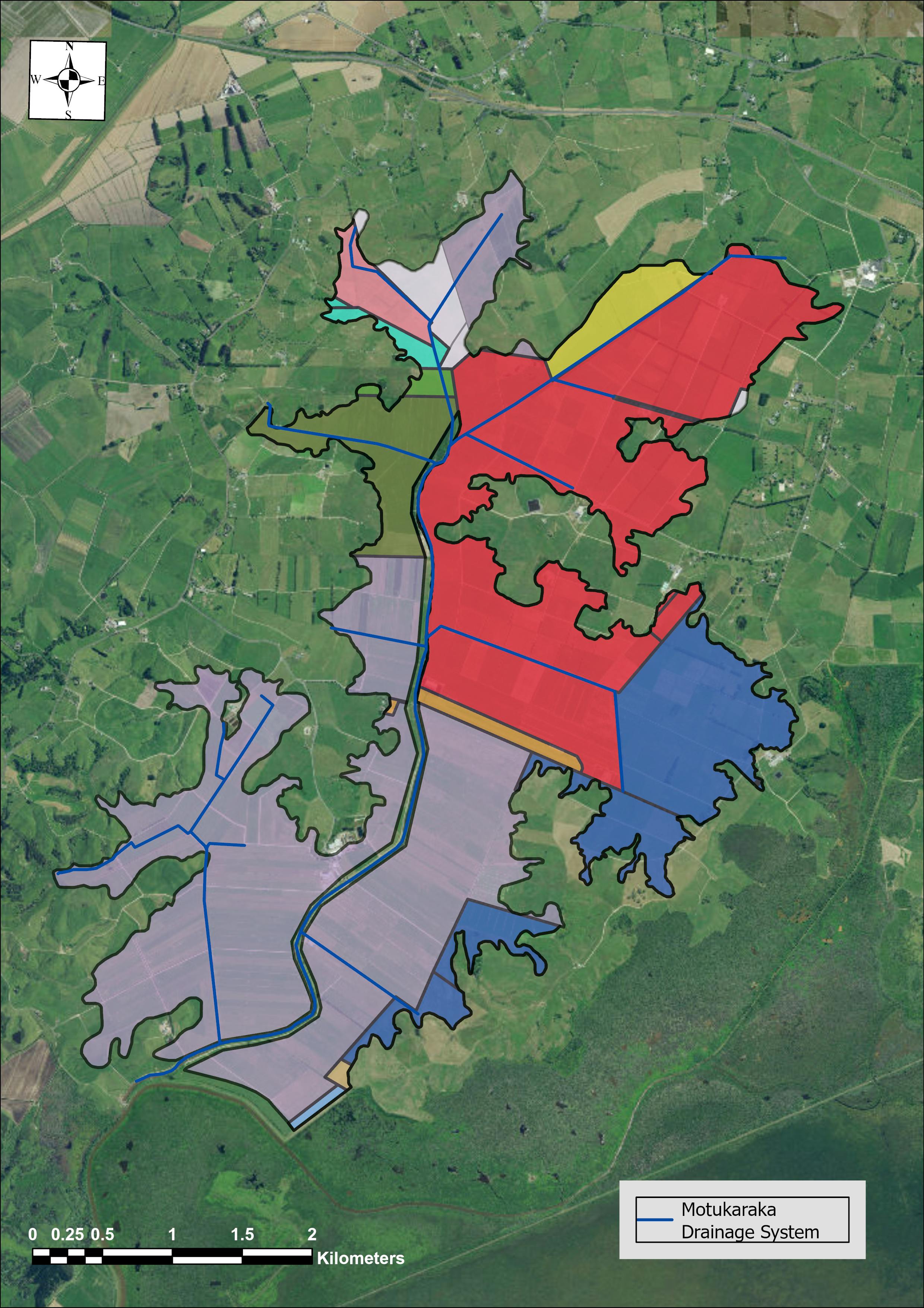
Motukaraka Catchment
The Motukaraka Catchment is located in the Lower Waikato Zone and is approximately 4,140 hectares with 3,260 hectares subject to flood protection and land drainage schemes.
The direct benefit area is approximately 1,440 hectares and primarily services the lower parts of the catchment.
The catchment contains highly productive land for food production and an airport that is looking to expand. It also has a water take consent, which has an important role in supporting the productivity of surrounding farmland.
Whangamarino Wetland, a Ramsar site of international significance and site of cultural significance to the iwi and hapū of the area, also borders the catchment so will need to be considered as we test the SIDF.